
Buff Pass: SPC BST
- Posted on
Weather Forecast
Snow should begin falling around 2am Tuesday and continue all day and into the night, with 4-8″ by EOD. Temps teens to low 20’s. Winds WSW 15mph gusting to 35mph.
Avalanche Danger
Large-Very Large Persistent Slab problem on all Asp & Elev Likely
Recent natural and remotely-triggered avalanches illustrate the ongoing dangerous conditions. Drifted snow from the last storms events formed stiff slabs that are stacked on worrisome weak layers in the middle and bottom of the snowpack. Avalanches breaking in the upper snowpack can step down into these deeper layers and produce avalanches that break wider and deeper than you might expect. The most dangerous slopes received the most recent wind loading and face northwest through northeast to southeast.
Give slopes steeper than about 30 degrees a wider buffer. Low-angle slopes without steeper connected slopes above you offer safer riding options.
The incoming storm will bring some snow, and has the potential to bring up to a foot on the upper end by tomorrow morning. Even small amounts of drifting snow will keep avalanche conditions dangerous, but be prepared for rapidly changing conditions.
The incoming storm system arrives with a healthy does of uncertainty. Surface observations and models were mostly in alignment yesterday, and showed a good chance for significant snowfall in the Steamboat and Flat Tops zone. The picture is much murkier this morning. There is still a chance we pick up a foot of new snow by tomorrow in the Elkhead and Park Ranges by tomorrow morning, but my confidence is much lower than yesterday even though the storm is upon us.
We issued an Avalanche Watch for this zone to account for the upper end of the forecast snow totals. If we fall short of these totals we will drop the watch and won’t reach High (Level 4 of 5) danger tomorrow. This will put the Steamboat-Flat Tops zone in the same boat as the rest of the Central Mountains.
Even small amounts of new and drifting snow will keep avalanche conditions dangerous. All the recent avalanche activity across the Northern Mountains was spurred by less-than-you-might-expect amounts of new and drifting snow.
Over the last few days we recorded a dozen natural avalanches, most D2 or bigger, in all the Northern Mountain Forecast zones. Add to that half a dozen human-triggered avalanches, some of which were triggered remotely, and another dozen avalanches triggered by explosive mitigation work, and we have a clear picture of dangerous conditions.
Remotely-triggered avalanches in the Steamboat zone, numerous natural and human-triggered in the Front Range zone, and similar widespread activity in across Vail-Summit zone (here, here, and here) demonstrate that the dangerous conditions are widespread across the region.
We recorded 65 avalanches across the region since the first of the month. All but one avalanche ran on northerly or easterly facing slopes. With all the recent storm snow, and all the subsequent drifting, we built thick slabs that are connected across terrain features. Continued snowfall and incremental loading through this week will keep danger elevated.
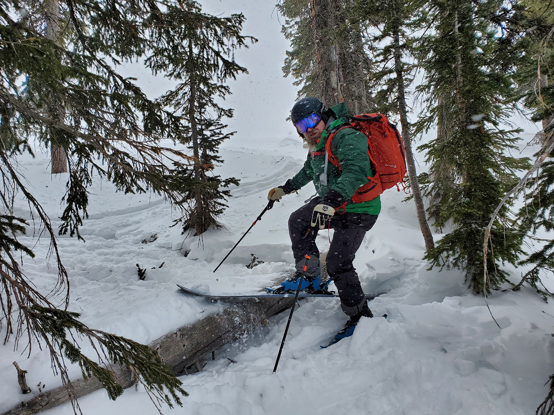
Ski Partners
The typical strategy when stepping back is to close terrain that has become suspect based on weather changes or evidence that creates uncertainty
Route
Snowmo from Dry Lake to East Ridge (Soda) and parked at North Pole drop. Skied 2 laps in the North Pole
Weather
Overcast with temps in the low twenties and light/moderate winds from the west. Precip rates up to 1.5″/hr. Evidence of recent wind transport. Conditions deteriorating with incoming storm.
HSN24
8cm
HSN48
8cm
Precip
S3
Sky
OVC
Winds
L/WSW
Temps
20F
Ski Pen
15cm
Foot Pen
35cm
Snowpack Observations
Recent storm & wind loaded slabs above a thick stiff mid-pack layer rest on buried facet layers and basal depth hoar
Avalanche Activity
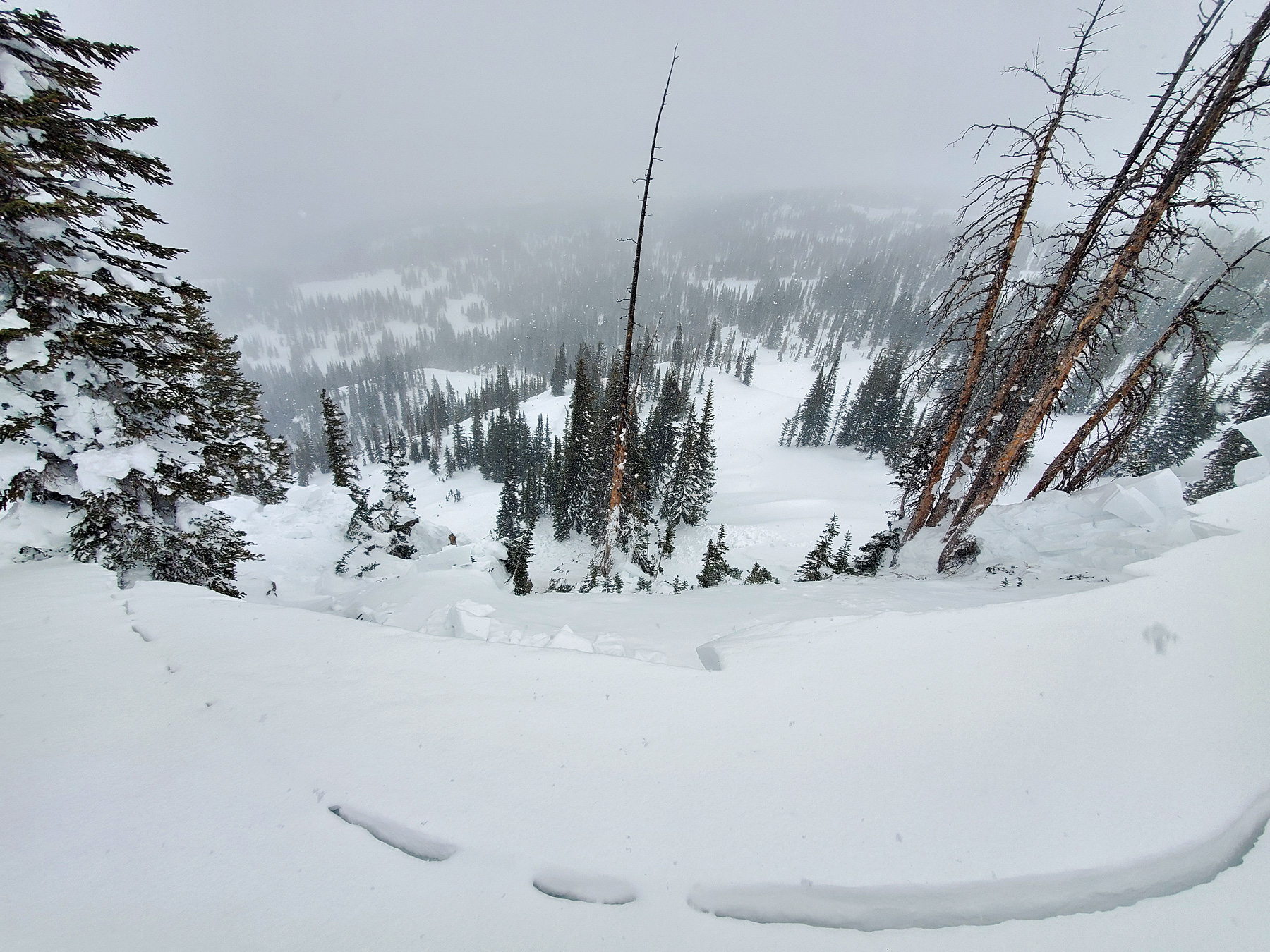
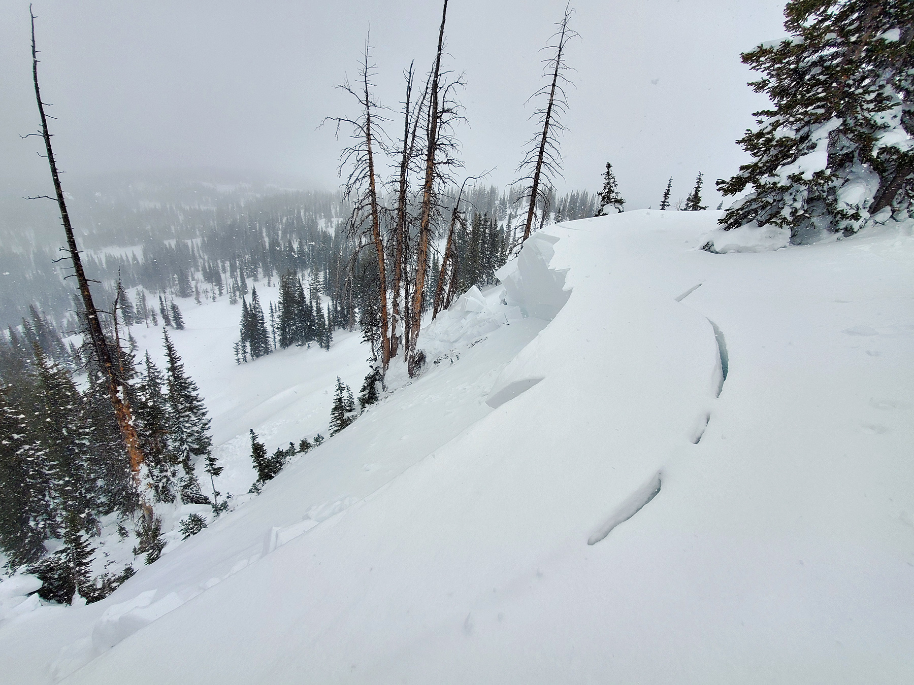
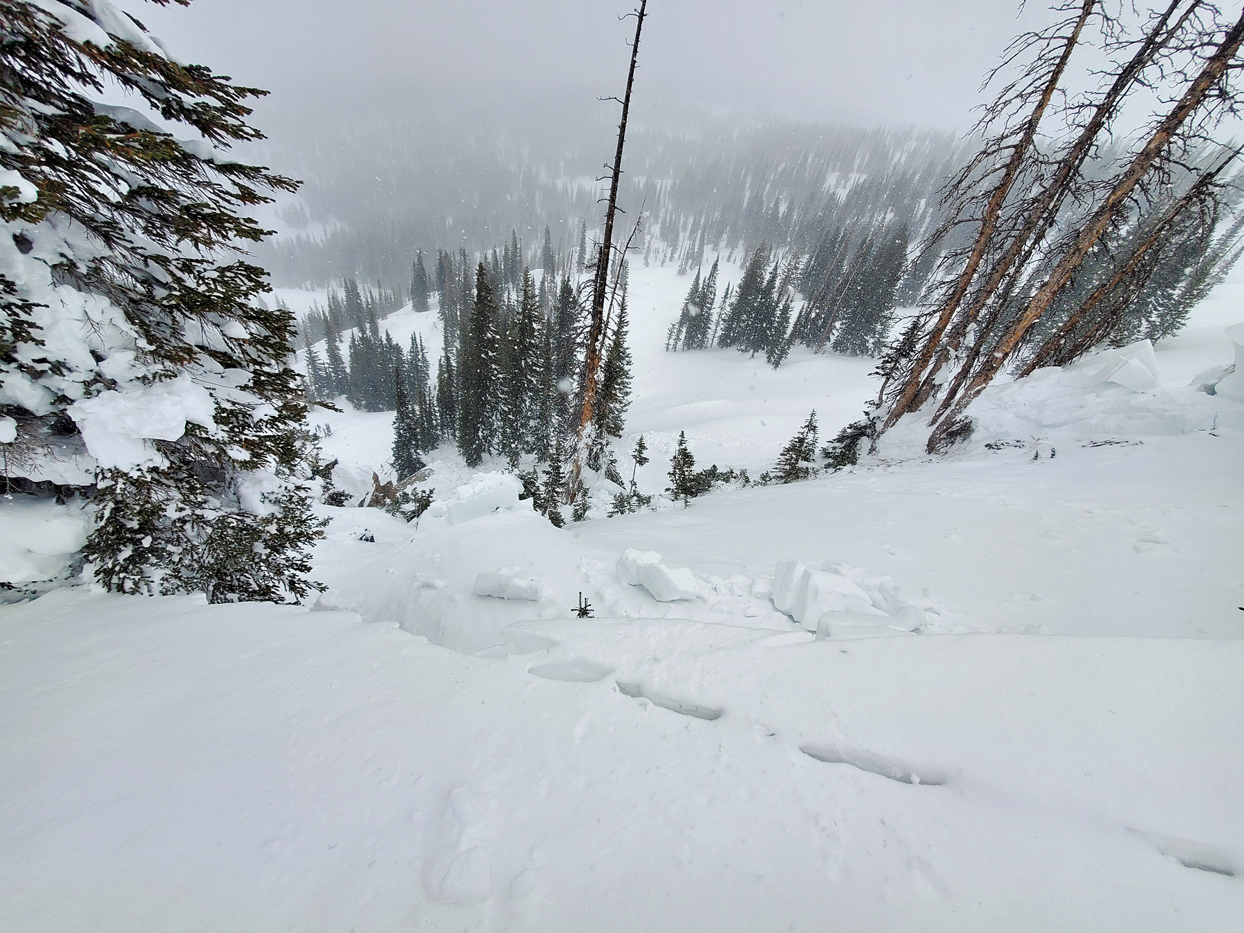
Noted 1x large natural or snomo-triggered hard slab avalanche on steep N facing slope 10,700ft (Toilet Bowl chute). Crown face was up to 10′ deep and ran 100’x250′ through trees before stopping on flat terrain.