
Buff Pass: Bitch Creek
- Posted on
Weather Forecast
On Wednesday we saw an additional 1 inch of accumulation, then on Wednesday night, the snow stopped falling.
Today on Thursday, I expect lots of clouds but little snowfall for most of the day, with a better chance for flakes late in the day and into the evening.
From Thursday late night to Saturday morning, we’ll have a high chance for snow and accumulations should be at least 6-12 inches and could be quite a bit higher. If the snow comes to fruition, conditions should be powdery on Friday morning and get softer through the day and perhaps be deepest on Saturday morning.
Avalanche Danger
Possible large to very large Persistent Slab avalanches on northwest through east to southeast across all elevations
Avalanches are becoming harder to trigger but don’t let your guard down. If you trigger a slide, it will likely break deep on buried weak layers or to the ground where the snow is the weakest. Avalanches like this one on Buffalo Pass that wipe out the entire season’s snowpack will be very hard to escape and could bury you deeply. Steep wind-drifted slopes facing northwest through east to southeast are the most suspect and likely places you can trigger an avalanche. Avoid slopes over 35 degrees where you find thick, dense slabs, overhanging cornices, or experience cracking and collapses.
Lower-angle slopes not connected to steeper terrain above will provide much safer riding options. Expect a rise in danger tomorrow as another storm impacts the region.
Ski Partners
Select a small amount of conservative terrain in which to operate confidently while more information is gathered to gain confidence in the hazard assessment.
Route
Snomo to Bitch Creek and checked out Cat Scratch and Mellow Gulley zone
Weather
HSN24
8cm
HSN48
30cm
Precip
S2 AM, S1 PM
Sky
OVC
Winds
Calm
Temps
25F
Foot Pen
35cm
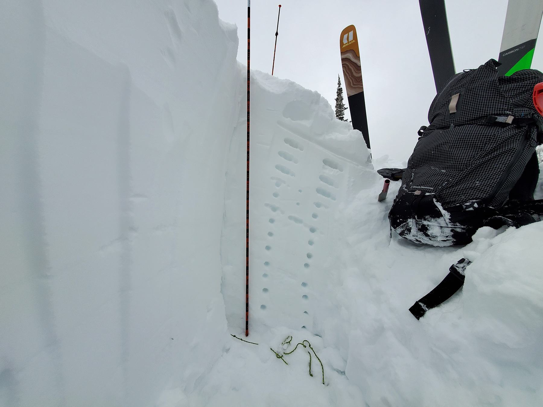
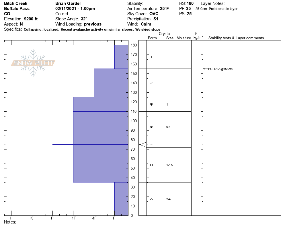
Snowpack Observations
N, 9200ft, 32*, ECTPX
180-155: F storm snow
155-125: 4f decomposing form
125-110 1f 1mm mixed form
110-75: 1f .5mm mixed form
75: 1f 5mm melt freeze
75-35: 1f 1-1.5mm facets
35-0: F 2-4mm depth hoar
Avalanche Activity
Intentionally triggered a soft slab avalanche in the storm snow on Cat Scratch (NNE, 9400ft). 10-12″ deep x 70ft wide and ran down to the flats.